
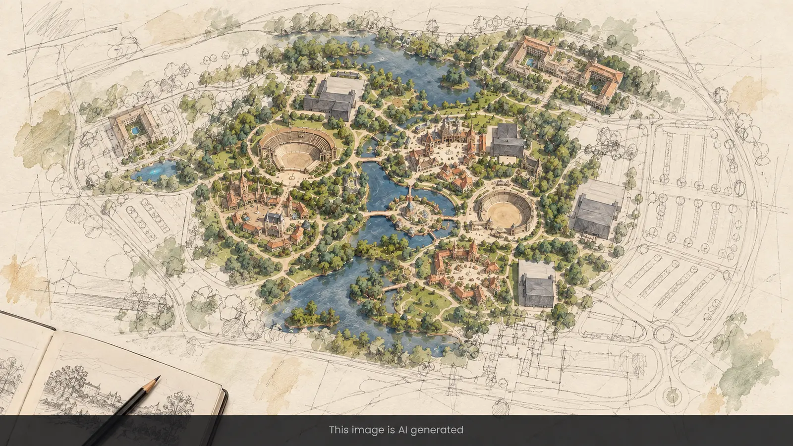
The published Puy du Fou UK masterplan shows how the proposed resort could be organised across the Oxfordshire site. It is useful for understanding the broad layout, but it is not a final visitor park map.
The current planning application is ‘outline’ with all matters reserved. That means the detailed design and arrangement can still change before construction and opening.
What does the proposed masterplan show?
The Design and Access Statement divides the project into broad functional areas including the Showpark, hotels and conference centre, parking and sustainable transport hub, and back-of-house infrastructure.
The Showpark is described as the main visitor area, containing indoor and outdoor shows, period villages, restaurants and heavily landscaped woodland settings.
Where would visitors arrive?
The proposals place arrival, drop-off, public-transport and shuttle-bus functions alongside coach, car and cycle parking. The wider planning material also proposes new access points from the B4100.
This is a proposed access strategy. Final road layouts, visitor routing and operational details may change through later approvals.
Where are the hotels?
The masterplan includes three onsite hotels, one associated with a conference centre. Public project material says the hotels are intended to be themed to different periods of British history.
Hotel names, final designs, room prices and booking arrangements are not yet confirmed.
Where are the shows and villages?
The outline plans show four period villages and 13 live-show venues: six outdoors and seven indoors. They show the broad layout rather than a finished visitor map, so attraction names are not confirmed yet.
What else is included on the site?
- Restaurants, retail and visitor facilities.
- Landscaping, woodland, paths, lakes and water-management features.
- Animal facilities.
- Staff, service, workshop, storage, medical and security areas.
- Waste, wastewater and energy infrastructure.
- Solar/PV infrastructure and water storage.
- Internal roads, pedestrian and active-travel routes.
The project is therefore much more than the public show areas visible to visitors.
Is this the final park map?
No. The safest description is “proposed outline masterplan”.
A final visitor map would normally come much later, once detailed design, phasing, construction and the actual opening-day offering are settled. Any Theme Park Trip visual based on the planning material should carry a clear disclaimer that locations and components are indicative.
How will this map page be updated?
We will update this page when amended masterplans appear, reserved-matters applications identify more detailed layouts, construction confirms real-world positions, or Puy du Fou eventually publishes an official visitor map.
Sources
- Cherwell District Council planning register — application 25/02232/OUT (checked 4 September 2026).
- Puy du Fou UK consultation website — homepage and Our Proposals pages (checked 4 September 2026).
- Cherwell application 25/02232/OUT and its Design and Access Statement